The Richardson's Adventures

Our holiday to Western Australia was initiated from the idea of taking our boys on a extended holiday prior to starting school. We have been camping in tent's, and more recently we had a camper trailer for 3 years. While the camper trailer served us well ( over 30 camping trips ), we have upgraded to our off road caravan. The caravan makes life easier for the overnight stay, quick pack up, and it also has air conditioning. Our holidays have been booked for 2 1/2 years and we have been planning in some sort of fashion since. We have upgraded the car to give hassle free motoring, not to mention the great V8 rumble.

Saturday 30 July 2011

El Questro

Stepping stones to Zebedee Springs
We left HV8 and travelled back into El Questro Wilderness Park (a million acre property).  We checked out Zebedee Springs which closes each day at 12:30 for preservation of the vegetation. 

Hot springs at Zebedee

Pigeon Hole Lookout
This lookout was closing after 12:00 noon for a wedding in the afternoon.  The bride flew out from El Questro Station in a helicopter.  The boys have done some huge walks the last few days so we did a big afternoon 4WDing.  Which has been Steven's most challenging 4WDs to date.


Branco's Crossing
This made the Pentecost Crossing look easy.  The photo only showed the first half of the crossing, what looks like the end in the photo, is only and island part to the crossing and the same distance covers the other side.

Branco's Lookout

Upper/Lower Split Holes

Sandwich Waterhole

Explosion Hole


Friday 29 July 2011

Home Valley Station (HV8)

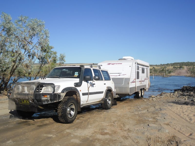
Gibb River Road Pentecost River Crossing
The people crossing in the above photo have taken a photograph of us crossing and towing the caravan.  We can only hope the photo will turn out.

Home Valley Station
Home Valley Station (HV8) has been bought by the Australian Indigenous Land Corporation (AILC) and used as and onsite training facility for young indigenous men and women of the Kimberleys.  It is believed that AILC has also bought Uluru and has visions to change the employment ration from 99.9% caucasians/backpackers to 30% Indigenous employment for these high volume tourist areas.  We spent a few days here.  Steven and I would highly recommend this place, especially after you had achieved the Gibb River Road from west to east.  They had a fantastic pool area, great bar and restaurant.  We LOVED it and could have easily stayed longer if time permitted. 


Our site
You couldn't wish for a better site, right in front of the childrens playground.  Jacob and Zachary couldn't be more excited.  The next morning, Jacob even prepared the bowls for breakfast and then had everyone's toothbrush with toothpaste ready for us, just so he could go out and play.

Play time

HV8 has a camp area along the Pentecost River
Rule no. 1 Don't camp near the bank, camp on the right side of the road (which is where I'm standing to take this photo).  The Cockburn Range in the background.  BIG salt water crocodiles (and people go fishing and launch there boats here).  CRAZY!!

                          
The boys have seen the very experienced walkers take to a walking aid, so they found there own sticks and walked with them through to the water falls.           


"I need a relax"
The boys have called a quick breather/water break as, "I need a relax".

Bindoola Falls

Bindoola Water falls

Fallen down a hole
Just kidding!  The boys were having some fun.

Jacob took this photo

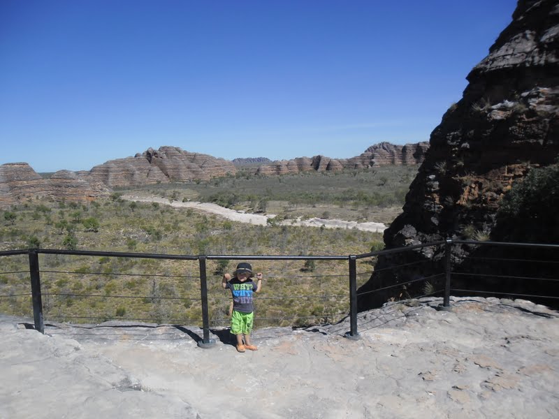
Lookout over Cockburn Range

Back across the Pentecost Crossing

We made it
Jen wouldn't get out and take a photo whilst we drove across the Pentecost Crossing along the Gibb River. (I don't know WHY)????


Thursday 28 July 2011

El Questro (Emma Gorge)

Rest along the walking track to Emma Gorge

Tough walk for our little man
The walking track for Emma Gorge is approximately a 2hr return trip.  It took us just under 4hrs, which included a swim at the rock pool.  The last 20mins Steven carried Zachary, and he went to sleep on Dad's shoulder.

Rock pool swim

Steven waving from a rock in the rock pool

Boys swimming

Tuesday 26 July 2011

Kununurra

Kelly's Knob Lookout

The view over Kununurra at Kelly's Knob
Kununurra is known as the fruit bowl for Australia. 
Kununurra's Diversion Dam, creating Lake Kununurra, was built in 1963.   In 1971, The Main Ord Dam 50 kms upstream was completed.  Lake Argyle covers and area of 1000 sq kms or 2100 sq kms at maximum flood capacity.  To gain perspective it is 18 times the area of Sydney Harbour. "If the dam ever does flood to its maximum capacity then the volume will be more than triple - and Sydney Harbour could be filled more than 52 times". 

Zachary & Jacob

Ivanhoe Crossing
Ivanhoe Crossing was closed due to the release of the Diversion Dam. Phew, I say.  Chances of meeting a salty (croc) is high.

The Sandalwood Factory

Hoochery Distillery

Rum Matured in old wine barrels

Inside the Distillery 


Monday 25 July 2011

Bungle Bungle Range

Helicopter pad
The boys were extremely excited to be camped near the helicopter pad.  Their excitement when the helicopter took off was wonderful to witness.


Purnululu National Park
The Bungle Bungle Range, that lies in the Purnululu National Park is truly spectacular.  Purnulula National Park is World Heritage listed for its natural beauty and geological rock formation.  It is hard to believe that the Bungle Bungle Range was only discovered as young as 1983 by a film crew, and by 1987 was established as a National Park.


Cathedral Gorge walk


Cathedral Gorge

Rest time

Walk to the Look out

Look out

The Domes walk

Sunset over the Bungle Bungle caravan park

Saturday 23 July 2011

Fitzroy Crossing

Geikie Gorge National Park
Today we explore Geikie Gorge along the Fitzroy river via boat.  This gave us a different geological view of the Gorge.  "Every wet season the river can rise ~ 16 metres above the old crossing and flow at 30,000 cubic metres per second.  In the wet season the Fitztoy River is one of the largest rivers in the world". 


Jen & Zachary

Steven & Jacob

Fresh water Crocodiles

Geological rock formation

The Fitzroy River 

Water line
 In the rock formation above, it looks like a side profile of a face.  The nose is the water indicator line in the wet season.


Tough Pub